Li Y.F., Lin J.Y., Li Y. and Nyerges T.. 2019. Land Degradation & Development, 30(9): 1107-1120.
Coastal areas of China have experienced rapid land development accompanied by an increase of impervious surface area often, leading to considerable environmental degradation, particularly for water quantity and quality. This land–water interaction within an urban milieu, called an Urban Land–Water System, involves critical ecosystem function loss and undesirable resilience change. With the purpose of identifying changes in spatial–temporal resilience of an Urban Land–Water System, we formulated an innovative quantitative method for resilience assessment based on the concept of critical functionality and Hooke's Law. The resilience assessment method contextualizes critical functionality of complex systems by integrating subsystems of impervious surface area with subsystems of water quantity and water quality. The method was applied in a study area named Lianyungang, whereby we compared different contributions of three subsystems within two scenarios, Scenario a (one‐fourth of impervious surface area, one‐half of water quantity, and one‐fourth of water quality) and Scenario b (one‐third for each subsystem). Overall, resilience degrades for the Urban Land–Water System from 2005 to 2010 to a relatively lower state with significantly increasing areas (from 62.88 to 281.50 km2) of low‐value resilience. Impervious surface area and water quantity were the main contributors to resilience change. In particular, the loss of resilience within Lianyungang was mostly due to the loss of evapotranspiration and increased built‐up land in both urban and rural areas. The resilience assessment method developed herein identifies areas of significant influences on nested and overlapping resilience change, thereby offering a practical approach for identifying hotspots for managing balances between different spatial–temporal subsystems.

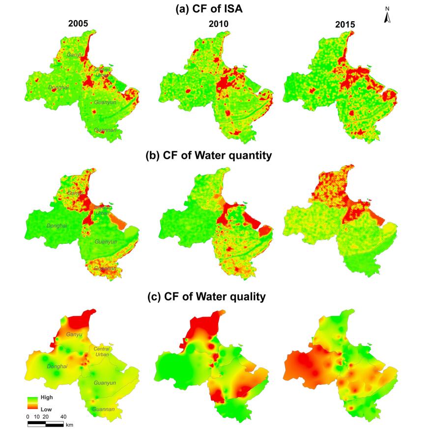
Figure 1. Spatial-temporal dynamics of critical functionality (2005, 2010, and 2015) for ULWS using three subsystems: (a) impervious surface area, (b) water quantity, and (c) water quality CF stands for Critical Functionality [Colour figure can be viewed at wileyonlinelibrary.com]

